A lasting disability affects more than a claim file. Learn how to connect the collision timeline with documented changes in work, household responsibilities, and expenses without treating assumptions as evidence.
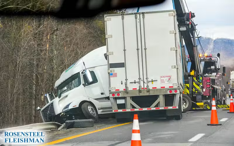

A highway truck crash may be described by an interstate number, a local route name, an exit, a mile marker, a nearby town, a ramp, a bridge, a county line, or a dispatch coordinate. Those descriptions may refer to different places: where a sequence began, where vehicles first contacted, where debris fell, where a truck stopped, or where responders staged.
A roadway-location record should identify the route, direction, county or municipality, mile or reference marker, intersection or interchange, ramp or mainline, lane, travel direction, collision area, final positions, and the source for every location statement.
Build the location description in layers
- State, county, municipality or unincorporated area, investigating jurisdiction, road owner when known, and source
- Interstate, U.S., N.C., secondary-road, local-road, or street identifier; signed name; alternate name; and travel direction
- Mile or reference marker, exit number, interchange, intersecting route, ramp designation, bridge, railroad crossing, work zone, toll facility, or other fixed reference
- Mainline, entrance or exit ramp, shoulder, median, travel lane, auxiliary lane, gore, intersection, private access, or adjoining property
- Latitude and longitude with device, file, coordinate system or map source, capture time, accuracy information, and preserved original metadata
Separate the first event from later positions
- Point where a hazard, braking, lane change, loss of control, cargo movement, mechanical event, or other sequence was first reported
- Area of first impact, later impacts, roadway departure, rollover, jackknife, cargo release, fire, or contact with a fixed object
- Final rest of each vehicle, trailer, load, person, object, or major debris field
- Responding-unit location, road closure, detour, evidence marker, measurement origin, photograph viewpoint, and inspection location
- Distance and direction among each point, who measured it, method, date, diagram, uncertainty, and later correction
N.C. Gen. Stat. § 20-166.1 addresses reports and investigations for reportable accidents. A statutory report requirement does not make every map label, code, coordinate, witness estimate, or officer conclusion identical in purpose or weight. Preserve the complete report and supporting records.
Read the DMV-349 location fields with the current manual
The NCDMV DMV-349 Instructional Manual explains fields for locality, road, distance and direction from a reference, road class, work-zone information, roadway features, sequence of events, diagrams, and narrative material. Transcribe the field and code as recorded, then keep any plain-language interpretation separate and cite the manual version used.
- Report number, agency, officer, report date, crash date and time, county, locality, route and secondary-road number
- Distance and direction from an intersection, bridge, railroad crossing or other reference and the named reference itself
- Roadway surface, alignment, traffic control, road configuration, work-zone and environmental fields relevant to the location
- Diagram orientation, north arrow, labels, measurements, vehicle paths, areas of impact, final positions, and narrative references
- Supplemental report, corrected code, amended narrative, reconstruction material, scale drawing, scene total-station data, or later agency record
NCDMV explains how eligible users may request North Carolina crash reports. Obtain the complete report and any available supplement rather than relying only on a screenshot, insurer transcription, news description, or map pin.
Reconcile independent location sources
For example, an exit number in a dispatch note may refer to the access route responders used, while a photograph shows the vehicles beyond the ramp. Keep both descriptions with their sources and ask which location each refers to. Do not return to an active highway or enter restricted property to recreate measurements; use existing lawful records and authorized scene work.
- 911 call, computer-aided dispatch entry, responder GPS or unit log, body-camera or dashboard-camera file, radio traffic, and road-closure notice
- Vehicle event or telematics data, electronic logging device, navigation history, mobile-device location, camera system, toll or weigh-station record, and carrier dispatch
- Native photographs and video with timestamps, metadata and viewpoint; business, traffic, doorbell or vehicle footage; and preservation status
- Witness description, address, travel direction, landmark, viewing position, timing, confidence, diagram, and later statement
- NCDOT roadway, construction, maintenance, signal, incident-response, mapping or asset record tied to the correct route and date
Preserve authentication and uncertainty
North Carolina Rule of Evidence 901 addresses evidence sufficient to support a finding that an item is what its proponent claims. Preserve the original file, creator or custodian, collection method, timestamps, metadata, transfer history, edits, export settings, and explanatory witness. A map created later should identify its inputs and should not be presented as a contemporaneous source.
A location inconsistency may reflect different reference points, road names, directions, mapping systems, entry times, or a genuine error. Keep all versions, request clarification, and identify the fact that remains uncertain. Exact location evidence helps organize the investigation; it does not by itself decide driver conduct, motor-carrier responsibility, causation, or damages.
The related guide on reading a North Carolina crash report explains the parties, vehicles, insurance, codes, diagram, narrative, and correction process.
Rosensteel Fleishman Car Accident & Injury Lawyers provides information about Charlotte truck-accident claims involving disputed highway locations. The legal analysis depends on the complete roadway, vehicle, witness, regulatory, medical, and source record.
Sources
Additional Trucking Accidents Articles
Reducing Reinjury Risk With Physical Therapy After a Truck Crash in Charlotte
Concerns about reinjury involve medical questions that claim records cannot answer. Learn how to organize physical therapy documentation, practical expenses, and scene evidence without drawing unsupported conclusions.
When Mobility Loss After a Charlotte, NC Truck Crash Has No Clear Diagnosis
An unclear diagnosis does not prevent a family from recording practical changes after a truck crash. Keep observations, added expenses, and unanswered claim questions separate.
How Insurers Review Worsening Pain After a Truck Crash
An early insurance review may start with an incomplete account. Dated records can help explain later changes in pain, work limitations, and expenses without treating symptoms as proof of an injury.