A serious bicycle crash can change how a person moves through daily life, handles work, manages transportation, and makes decisions about medical care. In Charlotte, where cyclists may share busy streets with commuter traffic, delivery vehicles, and turning drivers, the path back to routine can involve more than physical healing. It often requires understanding the […]
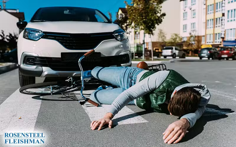

Getting into a bicycle accident can turn your world upside down. One minute you're enjoying your ride through Charlotte, and the next, you might find yourself on the ground, confused and possibly hurt. It's more than just the physical pain; the aftermath can be emotionally draining and legally complex. That's where understanding your rights and knowing who to turn to becomes crucial.
If you're ever in such a spot, remember that legal help is closer than you think. A Charlotte bicycle accident lawyer can provide the support and guidance you need. They're seasoned in handling such cases, knowing the local laws like the back of their hand. These attorneys stand ready to navigate through the legal maze, ensuring you're not alone in this. They aim to lift the weight off your shoulders, so you can focus on getting back on your feet.
Reaching out for legal assistance is straightforward. Initiating a free consultation with a personal injury law firm in North Carolina is just a phone call away at 1-704-714-1450. Whether you're seeking compensation or just need someone to explain your options, they’re there to help. Don’t let the confusion and stress of a bicycle crash overwhelm you; professional help is just around the corner.
Understanding Bicycle Accidents in Charlotte, NC
Bicycle accidents in Charlotte can happen suddenly and impact your life significantly. Riding through the bustling streets of Charlotte, NC, cyclists must navigate traffic, road hazards, and unpredictable weather conditions. Despite best efforts, accidents occur, leading to a need for skilled bicycle accident lawyers in Charlotte who can help victims understand their rights and the legal steps they can take. Implementing effective bicycle safety measures in Charlotte is crucial to reducing the number of accidents and ensuring the wellbeing of all cyclists. Local organizations advocate for more bike lanes and better signage to promote safer riding conditions. By raising awareness about these initiatives, residents can contribute to a community that prioritizes cycling safety and encourages more people to choose biking as a viable mode of transportation.
When an accident happens, it's not just about the physical injuries. The emotional toll, the pile-up of medical bills, and the potential loss of income can feel overwhelming. That's where a Charlotte bicycle accident attorney steps in, providing not just legal advice but also a reassuring presence that you're not going through this alone. These professionals are adept at handling the complexities of personal injury claims, making sure you receive the attention and compensation you deserve.
In Charlotte, NC, laws surrounding bicycle accidents are specific and detailed. Understanding these laws is crucial for anyone involved in a bicycle crash. A personal injury lawyer focusing on bicycle accidents can navigate these legal waters, ensuring that your rights are protected and advocated for. They help decode the legal jargon into simple terms, making the legal process less intimidating and more manageable.
Legal Rights and Options for Cyclists
After a bicycle accident, knowing your legal rights and options is essential. In North Carolina, cyclists have rights that protect them on the road, and understanding these can significantly impact the outcome of any legal actions taken post-accident. A top-rated personal injury attorney in Charlotte can explain these rights in clear, straightforward language, helping you to understand the legal pathways available.
Cyclists in Charlotte, NC, should be aware that the legal timeframe to pursue a claim, known as the statute of limitations, is limited. Therefore, consulting with a bicycle accident law firm promptly can make all the difference in your case. These law firms, experienced in representing cyclists, can assess your situation, guide you through the necessary legal steps, and work towards securing the compensation you're entitled to.
Choosing the right legal representative can seem daunting, but it's crucial for a successful outcome. The best personal injury lawyers in Charlotte are those who not only understand the law but also empathize with what you're going through. They're committed to representing your interests and ensuring that the legal process is as smooth and straightforward as possible. With their expertise, cyclists can confidently navigate the aftermath of an accident, focusing on recovery while their legal team handles the complexities of their case.
Choosing the Right Advocate: Rosensteel Fleishman's Commitment to Bicycle Accident Victims in Charlotte
Selecting the right law firm after a bicycle accident in Charlotte, NC, is a critical decision that can significantly impact the outcome of your case. Rosensteel Fleishman stands out as a dedicated Charlotte bicycle accident law firm, offering personalized and compassionate legal representation. Their team understands the intricacies of personal injury law, focusing on ensuring that every client receives the attention and expertise needed to navigate through their legal journey.
With a deep-rooted commitment to the Charlotte community, Rosensteel Fleishman offers more than just legal advice. They provide a supportive partnership, guiding clients through each step of their case, from the initial consultation to the final resolution. Their approach is client-centered, prioritizing clear communication, and making legal processes understandable and less daunting for those recovering from a bicycle accident.
The advantages of partnering with a local Charlotte personal injury law firm like Rosensteel Fleishman are numerous. They bring a wealth of local legal knowledge, understanding both the specific legal landscape of North Carolina and the nuances of personal injury cases involving cyclists. This insight allows them to craft more effective legal strategies tailored to the unique aspects of each case, enhancing the potential for successful outcomes.
How Rosensteel Fleishman Supports Bicycle Accident Victims
Rosensteel Fleishman's role extends beyond mere legal representation; they are advocates for their clients' well-being. They work tirelessly to ensure that victims receive the compensation they deserve for injuries, damages, and losses. Their attorneys are not just lawyers; they are allies who invest time in understanding the individual circumstances of each case, ensuring personalized and effective legal solutions.
The firm's expertise in handling bicycle accident claims in Charlotte ensures that clients receive knowledgeable guidance on their rights and the best course of action. They help demystify the legal process, providing clarity and reassurance in a challenging time. With Rosensteel Fleishman, clients gain a partner who is not only experienced in the legal field but also genuinely concerned about their recovery and justice.
In conclusion, choosing Rosensteel Fleishman means opting for a law firm that combines professional proficiency with a personal touch. Their dedication to achieving the best possible outcomes for bicycle accident victims in Charlotte, NC, has established them as a trusted name in personal injury law, making them a preferred choice for individuals seeking justice and support following a bicycle accident.
Why Rosensteel Fleishman Stands Out in Charlotte's Legal Landscape
When it comes to finding a trusted legal partner in Charlotte, NC, Rosensteel Fleishman Car Accident & Injury Lawyers have set a high standard. Their commitment to providing top-notch legal services with a personal touch has made them a favored choice among residents. What sets them apart is not just their expertise in personal injury and car accident cases but also their approach to treating clients like family.
Corey Rosensteel, co-founder of the firm, once said, "We believe in personal attention and dedicated service. Our clients are not just case numbers, but individuals with unique needs and concerns." This philosophy is evident in how they handle each case, providing tailored advice and steadfast support. Their deep understanding of North Carolina laws, combined with their compassionate approach, makes them not just attorneys but advocates for their clients’ well-being.
Choosing Rosensteel Fleishman means opting for a local Charlotte law firm that’s deeply integrated into the community it serves. This local presence is invaluable, providing clients with insights and advantages only a Charlotte-based firm can offer. Their familiarity with the local courts and legal system translates into strategic benefits for their clients, ensuring a more nuanced and effective representation.
Start Your Journey to Justice with Rosensteel Fleishman
Taking the first step towards resolving your legal issues can be daunting, but with Rosensteel Fleishman, it’s as easy as making a phone call. By dialing 1-704-714-1450, you can initiate a free consultation with a law firm that truly cares and is equipped to handle your case with the utmost professionalism and empathy. With Rosensteel Fleishman, you're not just hiring a lawyer; you're partnering with a team dedicated to getting the best outcome for you.
Additional Bicycle Accidents Articles
Benefit Coordination Bicycle Recovery Issues That Can Affect Medical and Wage Support
Coordinating benefits after a bicycle crash can affect how medical bills are paid, how missed work is documented, and how fault is evaluated when more than one source of support may be involved. In Charlotte, a rider may be dealing with health insurance, auto insurance, employer leave policies, short term disability, workers’ compensation questions, or […]
Communication with Employer Bicycle Injuries and Work Planning After a Crash
In Charlotte, NC, a bicycle crash can quickly affect more than medical appointments and bike repairs. For many families, the harder part is figuring out what to say at work, how much detail to share, and how to keep track of deadlines while recovery is still unfolding. Good communication with employer bicycle injuries can help […]
Fear of Traffic After Bicycle Accident in Charlotte and How It Can Shape Recovery
What should a person do when riding near cars suddenly feels unsafe after a bicycle crash? For many people in Charlotte, that reaction is not unusual, especially when the body is still healing and the mind is still trying to process what happened. A bicycle accident can leave visible injuries, but it can also cause […]